
It might be a little hard to be true but Annapurna circuit trek is considered the best trek of all time around the world. One who is a little curious about trekking in Nepal, The Annapurna Circuit Trek is one of the most iconic trekking routes in Nepal, offering an incredible journey around the Annapurna mountain range. It is famous for its diverse landscapes, which change dramatically from lush green valleys and terraced fields to high-altitude deserts and snowy mountain passes.
The highlight of the trek is crossing Thorong La Pass (5,416m), one of the highest trekking passes in the world. Along the way, trekkers experience rich cultural diversity, passing through traditional villages influenced by Hindu and Tibetan Buddhist traditions. With well-established tea houses, stunning Himalayan views, and gradual altitude gain, the Annapurna Circuit is considered a perfect blend of adventure, culture, and natural beauty, making it one of the most rewarding treks in the world.
Annapurna Circuit Trek : Complete Day-by-Day Real Experience Guide

The Annapurna Circuit Trek is a gradual journey that transforms from lush green river valleys into high-altitude desert landscapes surrounded by massive Himalayan peaks. Each day brings a noticeable change in terrain, culture, climate, and difficulty. Trekkers move from road-accessible villages into remote mountain settlements where life becomes simpler, slower, and more dependent on natural resources. As altitude increases, oxygen levels drop, and walking pace becomes more important than distance.
This itinerary is designed to help trekkers understand exactly what each day feels like — including travel time, altitude gain, accommodation quality, food availability, and real-world trekking conditions.
DAY 1 – Kathmandu → Besisahar → Dharapani
You begin your journey leaving the busy Kathmandu Valley and gradually enter rural Nepal. The drive follows rivers, hills, and terraced farms. After Besisahar, roads become rough and off-road conditions begin, signaling entry into trekking terrain.
| Aspect | Details |
|---|---|
| Travel Time | 8–10 hrs |
| Distance | ~170–190 km |
| Trek Time | No trekking (drive day) |
| Elevation | 1,400m → 1,860m |
| Difficulty | Easy (travel fatigue only) |
| Accommodation | Basic lodge / teahouse |
| Food | Dal Bhat, noodles, eggs, tea |
| Food Cost | NPR 400–800 per meal |
| Lodge Cost | NPR 800–1500 |
| Facilities | Basic electricity, limited WiFi |
| Hot Water | Limited / bucket system |
| Area Type | Semi-rural, small settlement |
| Speed Recommendation | Travel day – no walking |
| Nearby Exploration | Riverbanks, small village walk |
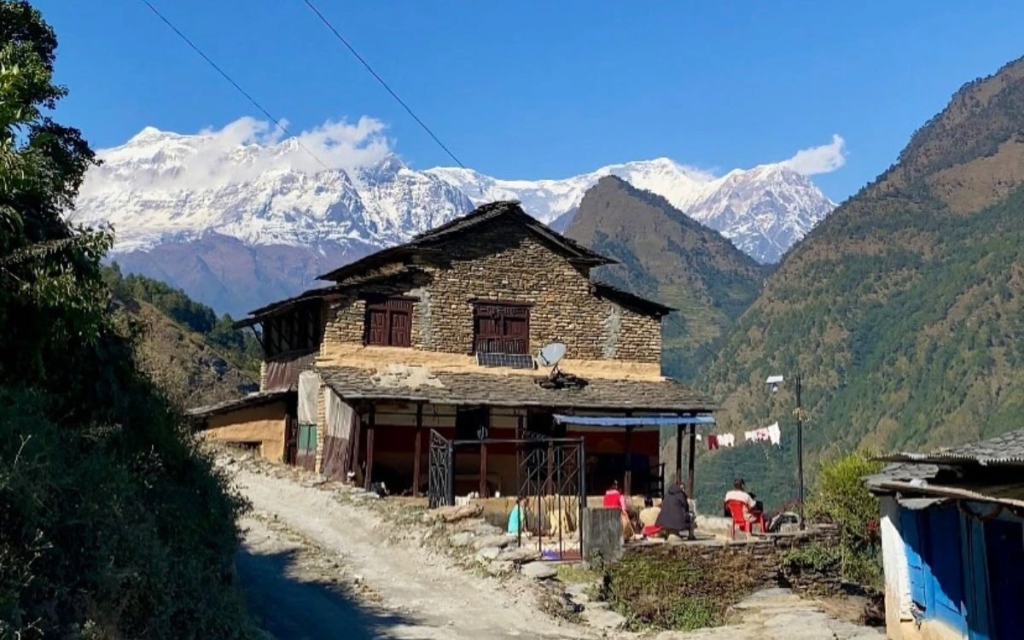
DAY 2 – Dharapani → Chame (2,670m)
The trail officially begins as you walk deeper into the Marsyangdi Valley. Forests become denser, waterfalls appear frequently, and suspension bridges connect villages. You start feeling true Himalayan trekking energy.
| Aspect | Details |
|---|---|
| Trek Time | 5–6 hrs |
| Distance | 13–15 km |
| Elevation Gain | +800m |
| Difficulty | Moderate |
| Accommodation | Comfortable lodge |
| Food | Dal Bhat, pasta, soup, potatoes |
| Food Cost | NPR 500–900 |
| Lodge Cost | NPR 1000–2000 |
| Facilities | WiFi available (paid), electricity present |
| Hot Water | Yes (solar/paid) |
| Area Type | Small but developed trekking town |
| Speed Recommendation | Slow-moderate (altitude adjustment begins) |
| Nearby Exploration | Apple orchards, river walk, monastery |
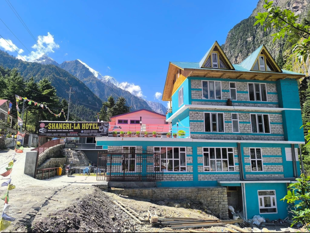
DAY 3 – Chame → Pisang (3,200m)
The landscape starts opening up, revealing wider valleys and first strong views of snow peaks. Air becomes cooler and thinner. You enter more Tibetan-influenced culture.
| Aspect | Details |
|---|---|
| Trek Time | 5–6 hrs |
| Distance | 14–16 km |
| Elevation Gain | +530m |
| Difficulty | Moderate |
| Accommodation | Teahouse / lodge |
| Food | Thukpa, noodles, tea, pancakes |
| Food Cost | NPR 600–1000 |
| Lodge Cost | NPR 1200–2200 |
| Facilities | Limited WiFi, electricity stable |
| Hot Water | Available (paid) |
| Area Type | Moderate settlement |
| Speed Recommendation | Slow steady pace |
| Nearby Exploration | Upper Pisang viewpoint, monastery |
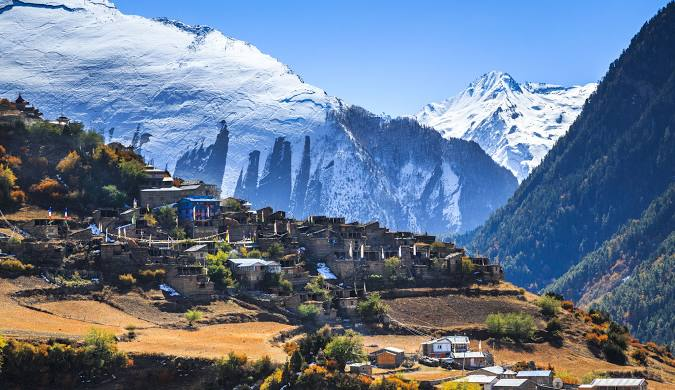
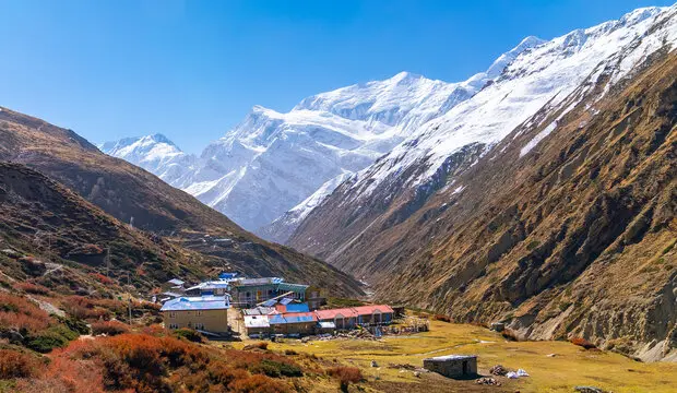
DAY 4 – Pisang → Manang (3,540m)
One of the most scenic transitions of the trek. You move into dry, alpine desert terrain. Mountains become massive and dominating. This is where acclimatization starts becoming important.
| Aspect | Details |
|---|---|
| Trek Time | 6–7 hrs |
| Distance | 17–19 km |
| Elevation Gain | +340m |
| Difficulty | Moderate |
| Accommodation | Good lodges (Manang town) |
| Food | Bakery items, pizza, soup, dal bhat |
| Food Cost | NPR 700–1200 |
| Lodge Cost | NPR 1500–3000 |
| Facilities | WiFi, bakery, ATM, shops |
| Hot Water | Yes (better quality) |
| Area Type | Developed trekking hub |
| Speed Recommendation | Slow (oxygen drop noticeable) |
| Nearby Exploration | Gangapurna Lake, monasteries |
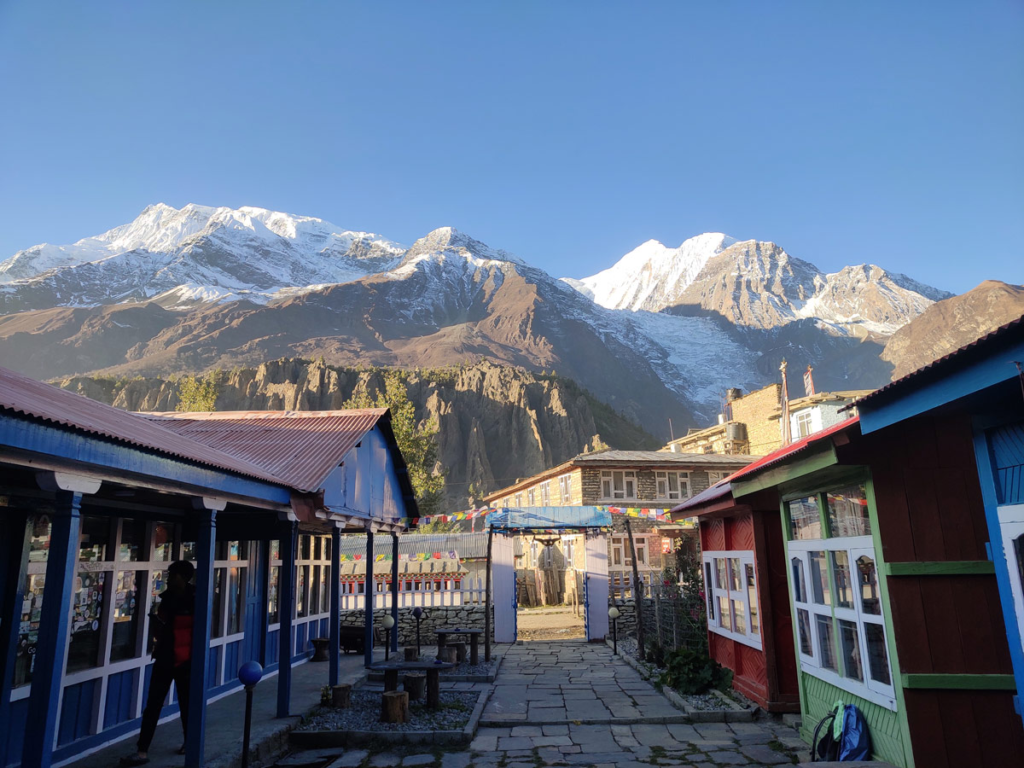
DAY 6 – Manang → Yak Kharka (4,050m)
Vegetation disappears slowly. Terrain becomes dry, windy, and open. Oxygen starts noticeably reducing.
| Aspect | Details |
|---|---|
| Trek Time | 4–5 hrs |
| Distance | 10–12 km |
| Elevation Gain | +500m |
| Difficulty | Moderate–Hard |
| Accommodation | Basic lodge |
| Food | Simple meals (dal bhat, soup, noodles) |
| Food Cost | NPR 800–1300 |
| Lodge Cost | NPR 1200–2500 |
| Facilities | Limited electricity, weak WiFi |
| Hot Water | Limited |
| Area Type | Sparse settlement |
| Speed Recommendation | Slow (energy conservation important) |
| Nearby Exploration | River valley, yak grazing areas |
DAY 7 – Yak Kharka → Thorong Phedi (4,450m)
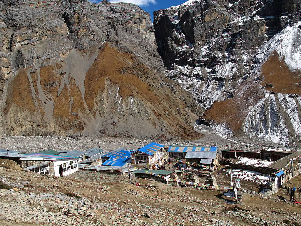
This is a preparation stage for the highest pass. Terrain becomes harsher and colder. Breathing becomes noticeably heavier.
| Aspect | Details |
|---|---|
| Trek Time | 4–5 hrs |
| Distance | 8–10 km |
| Elevation Gain | +400m |
| Difficulty | Hard |
| Accommodation | Very basic lodge |
| Food | Basic high-carb meals |
| Food Cost | NPR 900–1500 |
| Lodge Cost | NPR 1500–3000 |
| Facilities | Very limited |
| Hot Water | Rare |
| Area Type | Very sparse settlement |
| Speed Recommendation | Very slow, steady |
| Nearby Exploration | Glacier views, mountain slopes |
DAY 8 – Thorong Phedi → Thorong La Pass (5,416m) → Muktinath
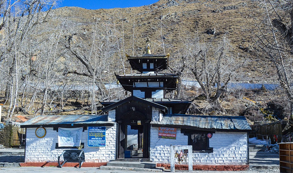
The most challenging and rewarding day. You start early morning in freezing cold, cross the highest point, and descend dramatically into Mustang region.
| Aspect | Details |
|---|---|
| Trek Time | 8–10 hrs |
| Distance | 15–18 km |
| Elevation | 4,450m → 5,416m → 3,800m |
| Difficulty | Very Hard |
| Accommodation | Hotel/lodge in Muktinath |
| Food | Hot soups, rice, Tibetan bread |
| Food Cost | NPR 1000–1800 |
| Lodge Cost | NPR 2000–4000 |
| Facilities | Better after descent |
| Hot Water | Available |
| Area Type | Pilgrimage + tourist town |
| Speed Recommendation | Very slow ascent, controlled breathing |
| Nearby Exploration | Muktinath Temple, monasteries |
DAY 9 – Muktinath → Jomsom
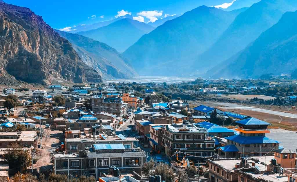
You descend into the dry Mustang valley. Landscape changes completely into desert-like terrain with strong winds.
| Aspect | Details |
|---|---|
| Travel Time | 2–5 hrs (drive/trek) |
| Distance | 20–25 km |
| Elevation Drop | -1,000m |
| Difficulty | Easy |
| Accommodation | Hotel |
| Food | Bakery, local Mustang meals |
| Food Cost | NPR 800–1500 |
| Lodge Cost | NPR 2000–3500 |
| Facilities | Good (electricity, WiFi) |
| Hot Water | Yes |
| Area Type | Developed town |
| Speed Recommendation | Relaxed |
| Nearby Exploration | Apple orchards, river valley |
DAY 10 – Jomsom → Pokhara
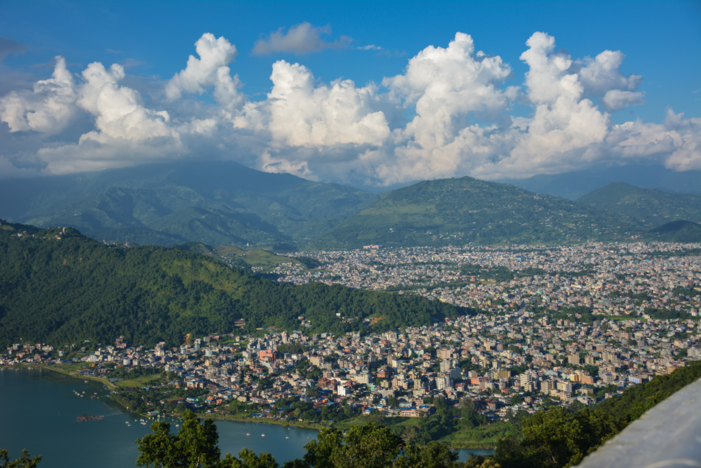
Final exit from trekking region. Either flight or long jeep ride brings you back to civilization.
| Aspect | Details |
|---|---|
| Travel Time | 20 min flight / 8–10 hr drive |
| Distance | 150+ km |
| Difficulty | Easy |
| Accommodation | Hotel (Pokhara optional stay) |
| Facilities | Full urban facilities |
| Highlight | Lakeside relaxation |